Historic Marbold Farmstead
- Home
- Marbold History
- The Association
- Renovation
- Events
- Education
- Supporters
-
Photo Albums
- Old FASHIONED Tea Party
- Auction November 2023
- Christmas 2023
- Fall Festival 2023
- Fall Festival 2022
- Grand Open 2021
- Fall Festival 2021
- Future
- Nature
- Artisans Fair 2019
- Antique Show and Farm Fest 2019
- Farm Day 2019
- Marbold Model
- Annual Meeting 2019
- Fall Arts and Crafts Festival 2018
- Antique Show 2018
- Farm Day 2018
- Annual Meeting 2018
- Fall Arts and Crafts Festival 2017
- Antique Show And Farm Fest 2017
- Farm Day 2017
- Farm Day 2017 2nd Grade Classroom Prep
- Annual Meeting 2017
- SummerFest @ the Farmstead
- Farm Day 2022
- 10th Anniversary
- Fall Festival 2022
- Virtual Tour >
- Newspapers
- Contact Us
- Videos
- Color
- Untitled
- Archived 2023 Announcements
- New Page
- New Page
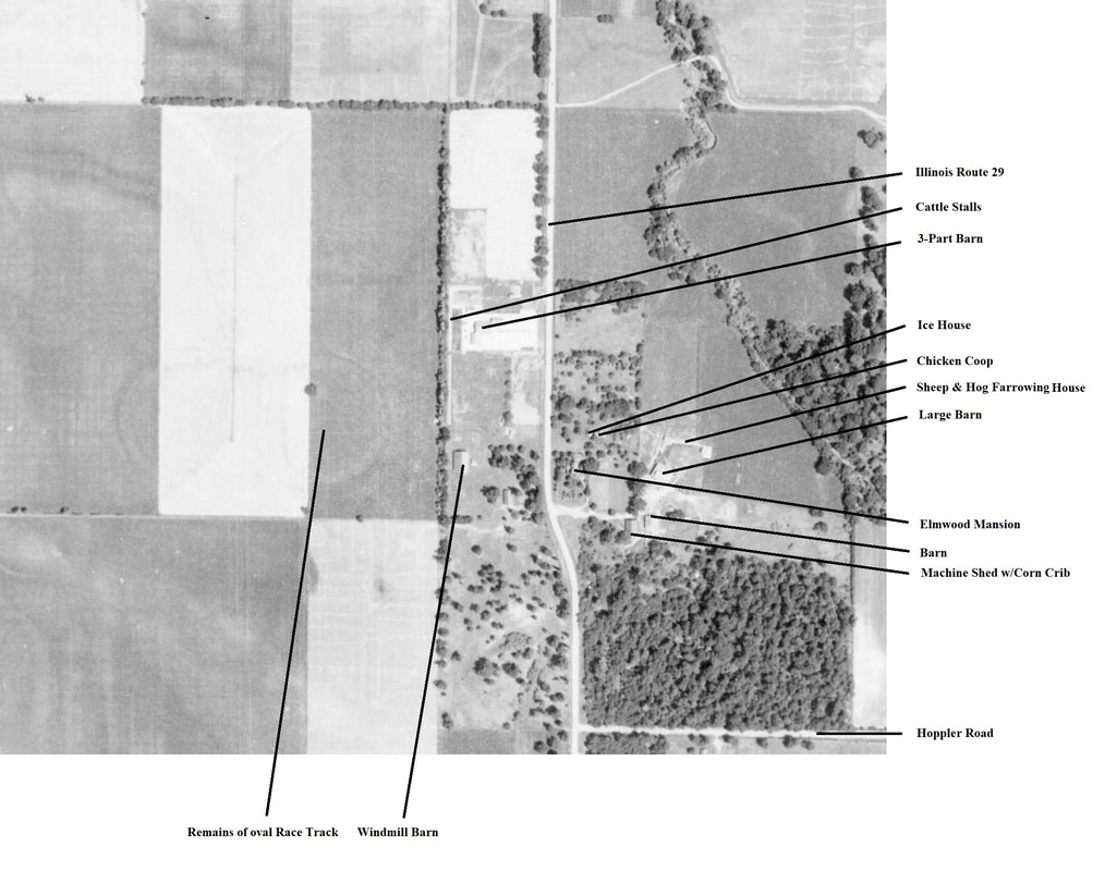
From 1937 to 1947, the State of Illinois sponsored a complete aerial photographic survey of the entire geography of the state. On July 7, 1939, they photographed the Greenview area. Using a digital copy from the Illinois State Geological Survey, we were able to recreate a composite map of what the farmstead may have looked like around 1900. First, please look at the 1939 photo below, since it serves as the basis for the composite:
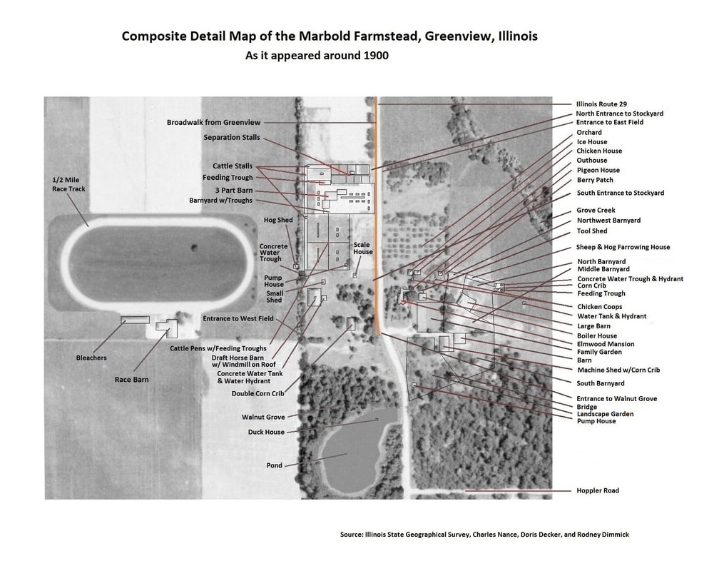
Starting with the 1939 photo and adding in other photographic evidence and personal knowledge from Doris Decker, Rodney Dimmick, and Charlie Nance (who was especially detailed in his memory), the following is the result. Some details are recreated digitally to make this appear to be an aerial photo of the 1900 farmstead:
- Home
- Marbold History
- The Association
- Renovation
- Events
- Education
- Supporters
-
Photo Albums
- Old FASHIONED Tea Party
- Auction November 2023
- Christmas 2023
- Fall Festival 2023
- Fall Festival 2022
- Grand Open 2021
- Fall Festival 2021
- Future
- Nature
- Artisans Fair 2019
- Antique Show and Farm Fest 2019
- Farm Day 2019
- Marbold Model
- Annual Meeting 2019
- Fall Arts and Crafts Festival 2018
- Antique Show 2018
- Farm Day 2018
- Annual Meeting 2018
- Fall Arts and Crafts Festival 2017
- Antique Show And Farm Fest 2017
- Farm Day 2017
- Farm Day 2017 2nd Grade Classroom Prep
- Annual Meeting 2017
- SummerFest @ the Farmstead
- Farm Day 2022
- 10th Anniversary
- Fall Festival 2022
- Virtual Tour >
- Newspapers
- Contact Us
- Videos
- Color
- Untitled
- Archived 2023 Announcements
- New Page
- New Page

